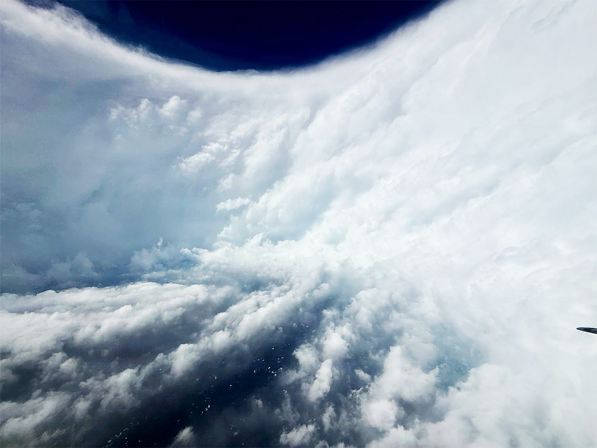
The recent landfall of Hurricane Melissa brought with it extraordinary footage captured by a team of aviators who ventured directly into the storm”s eye. On Monday, the US Air Force reserve crew from the 53rd Weather Reconnaissance Squadron, known as the “Hurricane Hunters,” shared striking videos and images that showcased their flight through the cyclone, aimed at gathering essential weather data.
The visuals display a surreal sense of calm within the storm”s eye, juxtaposed against the dramatic “stadium effect” created by the towering cloud formations surrounding it. This eyewall, as meteorologists refer to it, may seem to move at a leisurely pace, yet it is filled with the storm”s most ferocious winds. Additionally, breathtaking satellite imagery from the European Space Agency”s Sentinel-2 captured a direct view of the eye at its peak intensity.
Footage recorded during the flight highlighted moments of severe turbulence, prompting the experienced Hurricane Hunters to cut their mission short and return to their base in Curaçao, as reported by the National Hurricane Center. On a follow-up flight the next day, the crew faced similar challenges, being battered by intense turbulence once again.
Andy Hazelton, a scientist from the University of Miami who participated in the flight, expressed his astonishment on Twitter, stating, “My first time ever in a Category 5, and it was definitely the most turbulent I”ve ever experienced.”
Hurricane Melissa has been recorded as one of the most powerful Atlantic storms, boasting a diameter of approximately ten miles. As it approached Jamaica on Tuesday, the storm reached sustained wind speeds of 185 miles per hour and gusts of up to 215 mph, causing widespread destruction across the island. The Jamaican government has declared a disaster, with reports indicating that at least one parish is “under water,” and around 15,000 people are currently in government shelters.
While Haiti did not experience a direct landfall, it was still affected by heavy rainfall from Melissa, leading to the tragic loss of at least 25 lives due to flooding. As the hurricane has downgraded to a Category 2 storm, it is now moving across Cuba, where evacuations have taken place in anticipation of the storm”s impact. Following Cuba, forecasts predict that Hurricane Melissa will target the Bahamas.
Interestingly, Melissa”s structure seems atypical, as noted by Hazelton. The eyewall did not display the usual “stadium effect,” where clouds slope inward like seating in an arena; instead, it appeared more vertically cylindrical. Michael Lowry, a hurricane specialist at ABC”s WPLG-TV, suggested that this unusual structure may relate to why Melissa has been one of the longest-lasting Category 5 storms on record. He noted that most major hurricanes typically undergo eyewall replacement cycles that alter their structure and can weaken their winds. However, based on real-time data, Melissa did not form a secondary eyewall that could initiate this process, thus maintaining its intensity.


